Copyright © Hans Högman 2021-03-18
History of Railways in Sweden

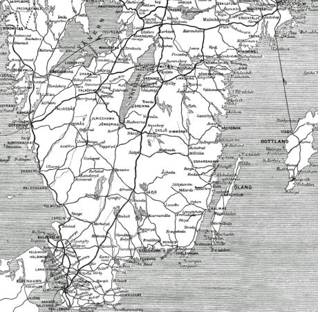
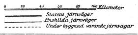
The image shows a
map of the railway
system in the
southern half of Sweden in 1910. Image: Nordisk
Familjebok, Projekt Runeberg.
Statens järnvägar = State Railways
Enskilda järnvägar = Private Railways
Under byggnad varande järnvägar = Railways under
construction
Related Links
•
Railway History, part-1
•
Railway History, part-2
•
Railway Occupations and Uniforms
•
Swedish State Railways - Locomotives
•
Iron Ore Line
•
Railway History - Images
•
History of Swedish Log Driving
Source References
•
Staten, järnvägarna och den regionala
utvecklingen i Sverige 1840–1890, Agaton Sten,
2015, Umeå Universitet.
•
Den glade rallaren? Norrbottniska rallares syn på
sina arbets- och levnadsvillkor, Per-Jonas Pihl
2016, Luleå Tekniska Universitet.
•
Boken “En rallares levnadsminnen”, av Samuel
Magnusson Svanbäck; nedtecknade av Herbert
Malmback, 1931.
•
Boken: “Banbrytare. Äventyr och upplevelser under
ett 100-årigt järnvägsbyggande i Sverige”. Manne
Briandt. Kristianstad 1959.
•
Sveriges järnvägars historia, Populär Historia, 13
september 2006 av Niklas Ingmarsson, publicerad
i Populär Historia 7-8/2006 .
•
Rallarna i Sverige banade väg för industrialismen,
av Mats Utbult, publicerad i Populär historia
11/2009.
•
Wikipedia
•
Järnvägsmuseet (Railway Museum in Gävle,
Sweden)
Top of page
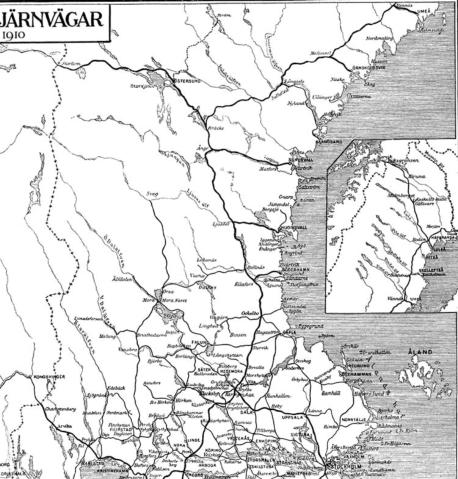
The image shows a map of the railway system in the
northern half of Sweden in 1910. Image: Nordisk
Familjebok, Projekt Runeberg.
Map of the Railway System in 1910 - Northern
half of Sweden
Map of the Railway System in 1910 - Southern
half of Sweden
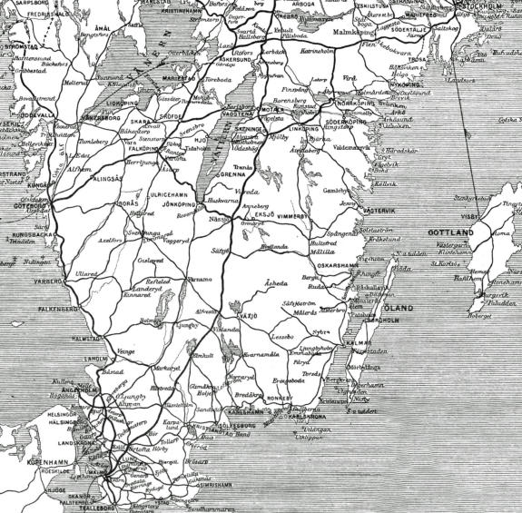
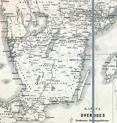
The image shows a map of the
railway system in the southern
half of Sweden in 1868. Image:
Postmuseum, ID: POST.050376.
Jernväg = Railway line. Jernvägsstation = Railway
station.
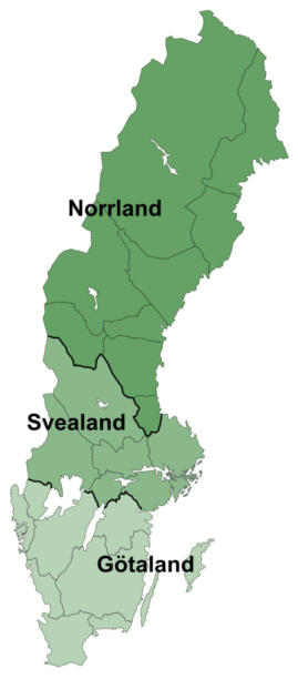
Maps of Sweden
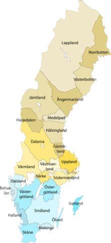
Map of Sweden showing
Sweden’s historic provinces.
Map of Sweden showing
the three “lands”;
Götaland, Svealand, and
Norrland. Stockholm,
the capital of Sweden is
located in the eastern
part of Svealand.