Copyright © Hans Högman 2021-03-18
Log Driving in Sweden

History of Swedish Log Driving - Maps
Introduction
Medelpad is a province in mid-Sweden and its major
city is Sundsvall. During the second half of the 1800s,
Sundsvall became the center of the world’s largest
lumber industry district. The Sundsvall region
became a lumbering Klondike.
The lumber industry was expanding fast during the
1800s. Steam power made it possible to establish
sawmills by the coast, easily reached by the shipping
lines. In 1849, the first steam-powered sawmill in
Norrland was established in Tunadal by the Alnö
Sound, just north of Sundsvall. Soon, more than 40
steam-powered sawmills were established along
Medelpad’s coastline, and alone in the vicinity of
Sundsvall city were 23 steam-powered sawmills
established.
Sundsvall is in Västernorrland County (Swe: Län)
located between two rivers, Indalsälven in the north
and Ljungan in the south.
Medelpad quickly grew as the major center for the
lumber industry.
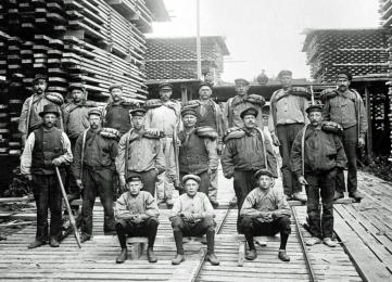
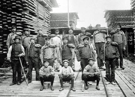
The image shows sawmill workers and piles of boards
at Gustavsberg Sawmill in Alnön, Sundsvall, 1908.
Image: Sundsvall Museum, ID: SuM-foto021393.
The Swedish poet and author Elias Sehlstedt (1808-
1874) visited Sundsvall at the beginning of the 1870s
and was amazed by the many sawmills in the area.
He wrote a poem called ”Songs about Ångermanland”
published in 1873 where he uttered the famous
phrase “Såg vid såg jag såg hvarthelst jag såg”. It’s a
wordplay and not easy to translate but it reads
something like this: “Saw by saw I saw wherever I saw”.
Maps of Sweden
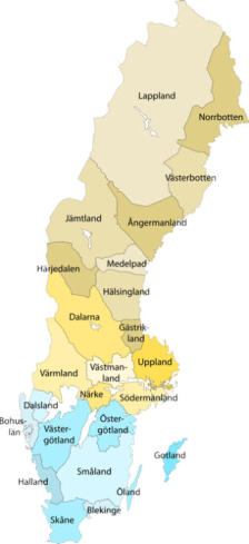
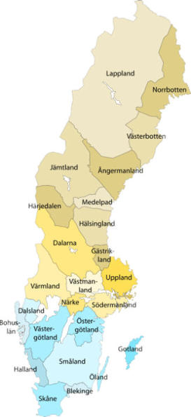
Map of Sweden showing
Sweden’s historic
provinces. Medelpad is
in mid-Sweden and
Sundsvall is located by
the coast in Medelpad.
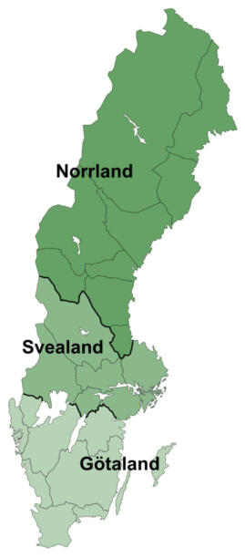
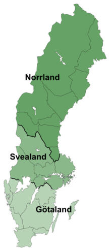
Map of Sweden
showing the three
“lands”; Götaland,
Svealand, and
Norrland. Stockholm,
the capital of Sweden is
located in the eastern
part of Svealand.
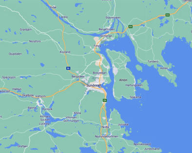
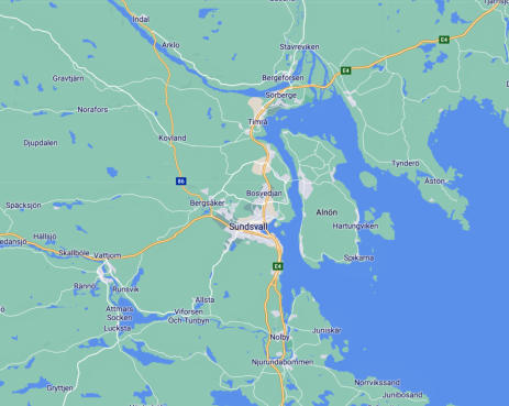
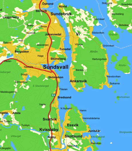
Map showing the eastern part of Medelpad with
Sundsvall City by the coast. Alnön is an island just
east of Sundsvall. All the about 40 steam-powered
sawmills in the vicinity of Sundsvall were located on
the coastal strip from Skönvik 10 km north of
Sundsvall to Svartvik 10 km south of Sundsvall, a
stretch of 20 km. A great deal of the many sawmills
was located on the west coast of Alnön.
Related Links
•
Maps,the subdivisions of Sweden into lands,
provinces and counties
•
Map, Swedish provinces
•
Map, Swedish counties
•
The Conception of Crofts and Crofters
•
The Old Agricultural Society and its People
•
The Swedish Emigration to the USA
Source References
•
Flottarna fick fart på exporten: Timmerflottning,
av Nils Johan Tjärnlund, 6 juli 2010. Tidskriften
Populär Historia 6/2010.
•
Skogen, flottningen och Norrbottens människor,
Skogshistoriska Sällskapets Årsskrift 2016, sid 12-
21.
•
Flottningen i Norrland, Lars Karlman jk 92/96.
•
Sågverksindustrins utveckling i Norrland; från
1850 till andra världskriget. Inst. för
vegetationsekologi och inst. för skogsskötsel SLU
Umeå, Åsa Blom, Erik Willén 1991/95.
•
"Nyfiken på Sverige", Utbildningsradion (sid 4)
•
"Ådalen, industrihistorisk inventering", del 3,
1980, (sid 20 - 21)
•
Wikipedia
Top of page
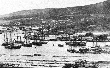
Sundsvall’s harbor in the 1870s during the lumbering
boom.
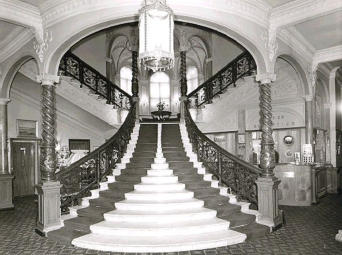
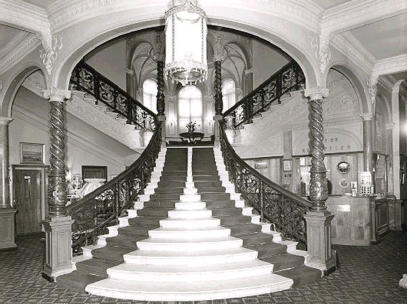
Hotel Knaust in Sundsvall is a well-known hotel &
restaurant frequently visited by the wealthy lumber
tycoons around the turn of the century 1900. The
image shows the famous marble staircase at Hotel
Knaust. Image, 1966, Wikipedia.


